TALES OF OUR TRAVELS AND OUR LOVE OF ADVENTURE

Tuesday, July 20, 2010

Black Canyon of the Gunnison National Park

Since we are camped only about 30 miles from Black Canyon of the Gunnison National Park, we decided to spend the morning there yesterday. It's a quick zip up the 550 to Montrose, then a few miles east on the 50 to the turnoff for the park. You make your way up a good-sized ridge (the edge of the Gunnison Uplift), pay your $15 entrance fee, and drive to the first overlook.

View east from Tomichi Point, the first viewpoint you get to after you enter the park.

One of the views from Gunnison Point, near the Visitor Center

Looking down at the Gunnison River in the bottom of the canyon.

Another view of the Gunnison River

The canyon wall just north of the Visitor Center

Looking east from Gunnison Point

Looking down from Chasm View - this is where the canyon walls are closest together. A ranger who had just finished a geology talk (darn, we missed it!) said the North Rim is only 1100' away.

Looking northwest from Sunset View.  You can see the western edge of Grand Mesa, along with two  geological curiosities:  the uncomformity above the gneiss/monozonite and below the Entrada sandstone and Red Canyon.  The unconformity means that millions of years of rock were worn away on top of the gneiss/monozonite before the thin Entrada sandstone layer was laid down.  You can barely see a portion of the Entrada at the top left at the center of the ridge, and another part of it at top right.

View from Cedar Point


We did NOT plan the lookalike blue shirts.


View west from Painted Wall View

This gnarled juniper reminded me of a bristlecone pine


The Painted Wall.  It looks like this because molten pegmatite, the pinkish rock, came up and filled all the cracks in the gneiss.  It solidified, making the wall even more impermeable.  


By the time we'd finished viewing all the viewpoints - some with nice hikes to get to them - it was 12:30 and blazingly hot.  We drove back into Montrose and enjoyed a nice lunch and lots of iced tea at Applebees before returning to our campsite in Ridgway.  And, of course, Don spent another successful evening on the river.

Dallas Creek

July 17

It's just has hot here as it is in many parts of the country - and while we have electricity and can run the air, it's much nicer to head to high country so Don can fish and I can relax in the shade with a good book.  We'd read in our little fishing guide that upper Dallas Creek had a small lake - so we decided to go up there. Dallas Creek's source is a cirque below Mt. Sneffels, so the road goes all the way up to the Blue Lakes trailhead. 

Mt. Sneffels, 14,150'
We were unable to find the lake - which turned out to be a beaver pond we saw on our way back down - so we stopped at Willow Swamp Campground so Don could fish Dallas Creek.  It isn't really a campground - just a parking area with dispersed places for people to set up, and Willow Swamp really isn't a swamp - it's a gorgeous meadow that runs along Dallas Creek.

Looking south over Willow Swamp towards Mt. Sneffels.  

We stopped in the clearing just to the left of the middle center.  I put my chair out in the shade and chased the shade for two hours.  After lunch I told Don he had about one more hour until I lost the shade up on the hillside (can't put my chair on a slope!).  It was hot, even at that altitude, so shade was a must.

He caught lots of fish - so it was yet another successful day!

Owl Creek Pass

July 16
Like I've said in a previous post, I've always wanted to see "what's on the other side."  In this case, it's Owl Creek Pass, east of Ridgway.  Owl Creek Pass is famous for having several scenes from the movie True Grit shot here.  It's also considered by many to be one of the prettiest drives in Southwest Colorado, especially in the fall when the aspen are turning.

We saw in our book about fly fishing southwestern Colorado that the upper forks of the Cimarron River had some nice places to fish, so Don packed up his gear, I made a snacky lunch, and we took off.  The road is dirt, and rough in some places, but it's maintained for passenger cars. About halfway up there's a viewpoint - where I insisted Don stop so I could take a photo of the Sneffels Range to the southwest.

Picture this area dotted with golden aspen in the fall.  Mt. Sneffels is the large peak in the center left.


Aspen and more aspen.  Millions of them.

Chimney Rock near the top of Owl Creek Pass.


When we came down off Owl Creek Pass we took a right turn up the West Fork of the Cimarron River.  About two miles up, we found a nice spot where Don could do some fishing, and I put my chair under some trees to read and cross stitch while he fished.  This is the view south up the creek. I believe the name of the mountain in the center is Comb Ridge.

This was my view across the creek from my chair.  So nice!

Don caught (and released) several small fish in this creek.  After a couple of hours we drove down the road to look at the Middle and East Forks - and ended up at Silver Jack Reservoir.  There's only one spot where you can get down to the reservoir - and it takes you to some muddy flats that didn't interest Don at all.  

From there we continued north along the Cimarron River, and found the best fishing at Big Cimarron Campground right along the river.  Another couple of hours there and we were done for the day.  Instead of going back upriver and over Owl Creek Pass, we drove north (and downriver) to Highway 50 - which we took into Montrose and then got on the 550 back to Ridgway SP.

Ridgway State Park - best site

The best site in Ridgway State Park, in our opinion,  is the one we're in.  Yes, I've seen people post on forums about how nice it is at Dakota Terraces or Elk Ridge, but our site, #254 in Pa-Co-Chu-Pak, has got to be the best.  Here's why:  first of all, it's at the end of the loop, with no one next to us.  We face out into a large field that has a seldom-used pavilion in it.  Every morning we've been here, we take our coffee outside and watch the deer come out of the creekbed to the east and slowly make their way to the river and back.  One of the deer has a fawn that trots along after her.  So nice.  We're also close to the trail that goes down to the river - so Don only has to go about 75 yards to the water.  The sites that look like they're on the river are actually on bluffs above it - with steep dropoffs.  This site has the river access that Don needs.

Silverton - one of my favorite places

July 14

While Creede is definitely my favorite little Colorado town, Silverton is high on my list of favorite places to go.  It stems from my college days - every year I'd take a minimum course load at Texas Tech, and work as many hours as I could at Furr's Supermarket in order to a) pay for the previous summer's gas, and b) pay for the coming summer's food and expenses. (I'd used gas credit cards.)  As soon as final exams were over in May I'd hit the road for Colorado, and several summers I took the train out of Durango or Silverton and head for the Weminuche Wilderness.  There was one summer I'd planned to hike the Continental Divide Trail from Monarch Pass to Wolf Creek Pass, and had a resupply cached upriver from Silverton.  [Dad started that hike with me, but both of us were turned back due to heavy snow in the Cochetopa Hills - and we learned that it was even worse at the higher elevations.]  But we still ended up in Silverton anyway, since I had to go back and get the cache and the food and cash in it.

The last time we were in Silverton was in 1991 - Don, the kids, and I were camped on the West Dolores, with train reservations. Dad was supposed to meet us at our campground the next evening, but he surprised us by meeting us in Silverton. That visit, and that town, still hold special memories for us.


The drive south out of Ouray takes you up into a deep canyon first - the beginning of the Bear Creek National Scenic Trail and the Alpine Loop are there.  You come out into a wide valley, with a view to the south of the four Red Mountains.  They were heavily mined in the late 1800s - there were SIX towns strung along this valley  ending with the town of Red Mountain at the top of the pass. 


Some more mountain scenery along the way.

Red Mountain #4 and the heart of the Red Mountain Mining District


When we arrived in Silverton, our first stop was the Museum.  It's been greatly expanded since they were given the old jail building, and it has a exhibits on mining and local history.


An old ore bucket


Two grinding machines. Notice the bicycle-type seats for sitting and spinning the grinding wheels.


Old wagon for hauling supplies


We strolled up and down the main street of Silverton for a while, and stopped for lunch at Handlebars - the same place we'd had lunch with Dad back in 1991.


Don was intrigued by this old halftrack sitting in front of the VFW Hall.


This is Arrastra Gulch, which was heavily mined for many years. The Silver Lake Mine is up in the center, and there's an aerial tramway from the top of the gulch down to the stamp mill in the Animas valley.  Not only did the tramway move buckets of ore, but miners rode in the buckets - sort of like we ride ski lifts today.


This is the stamp mill - currently undergoing renovation to be turned into a money-making enterprise giving tours to tourists.

A few more hours in Silverton and we headed back north towards Ridgway.  Along the way we stopped for about an hour at Crystal Lake, where Don unsuccessfully fished for some of the many trout we saw in the water.


A very pretty little lake; the fish just weren't biting.
This is typical of many streams in the Red Mountain area - the red colorization from the mine tailings.

We continued on our way, getting back to Ridgway in time to eat a cold dinner of cereal (what I love to eat when it's hot outsides) and for Don to go fishing on the Uncompahgre.  He fishes that river every evening - there's a two-mile stretch through the park below the dam that is full of trout. It's artificial flies/lures only, catch-and-release, so the trout population remains stable with lots of big ones. 


Wednesday, July 14, 2010

A Day in Ouray

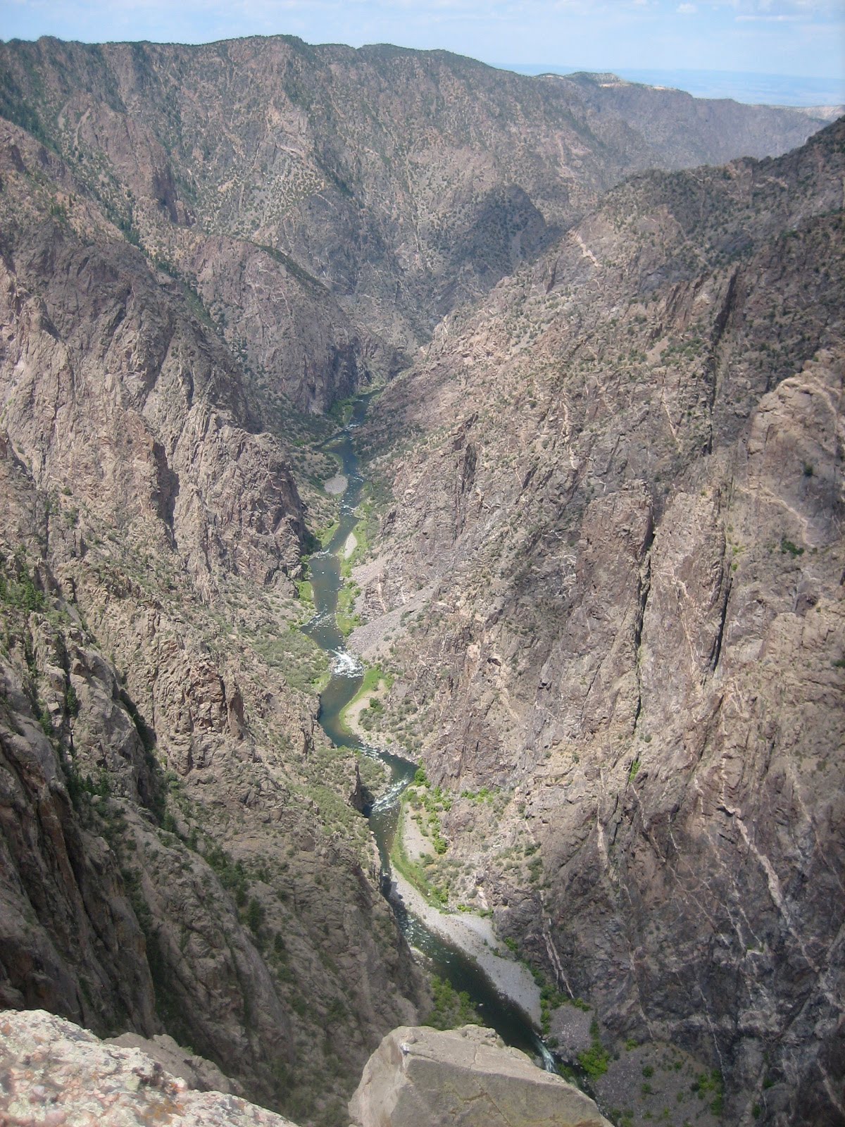
Ouray is called "The Switzerland of America." While its elevation is not that high (a little over 8,000'), it's ringed by very high mountains and is just a lovely setting for a town. It's rich in mining history, and is now fancied by tourists, cyclists, bikers, hikers, and climbers. It's at the northern terminus of the Million Dollar Highway - a twisting, climbing highway that runs from Durango to Silverton to Ouray.

Don and I have not been to Ouray before- we stayed in the Ouray KOA one night in 1991, but it's south of town and we never went into town. The last time I'd been there (without him) was in 1976, and I barely remember it; I'm sure it's changed a lot in 35 years.

The first thing we did was what we call "being tourists." We parked the truck at one end of the main street, and spent a couple hours walking up and back, stopping in whatever stores caught our fancy. We stopped for coffee at Mouse's Chocolate and Coffee, and walked out with a bag of their famous "Scrap Cookies." They take a bunch of cookie dough, probably a typical chocolate cookie recipe, and chop up all kinds of leftover scraps from the candy making. The cookies have anything and everything - dried fruit, chocolate, caramel, nuts, coconut, and bit of different fillings from the fancy chocolates. They are absolutely delicious - and it's quite fun being surprised at what you're going to get from each one.

Next we visited Box Canyon Falls. These are southwest of town, and drop several hundred feet through a fissure in the rocks caused by some major faulting.   After you pay your $5 entrance fee, you have two choices of trails:  the High Bridge Trail and the Falls Trail.  I always like to get the more difficult trail out of the way first, so we took the High Bridge Trail. First, you climb up a bunch of iron stairs, then a rocky trail that takes you several hundred feet above the falls and canyon.  


Looking upstream from near the High Bridge.


Looking northeast towards the town of Ouray from near the High Bridge.

The tunnel leads to a portion of the Ouray Perimeter Trail - a high-altitude hike that goes around the entire town.  You can't get back to the parking lot from here, so we didn't take it.


Instead, we hiked back down (I love going down!) and took the Falls Trail into the box canyon from which the falls are named.  You can't see the entire waterfall because it comes down a rock chute - but you can hear it thundering. 

The base of the falls.


Looking downstream from the base of the falls - see the old mining equipment up on the right?


This is looking straight up at the High Bridge.


Coming back up, we noticed this sign, so we started looking.  

Sure enough, not more than 10 feet from the trail was this nest with a large swift sitting on her eggs.


From Box Canyon Falls we drove over to the southeast side of town to check out Amphitheater Campground.  We discovered that it's really not for motor homes or trailers longer than 25' - though the camp host had gotten a large fifth wheel up there.  There's a narrow road that climbs the side of the mountain to get to it, so narrow that two vehicles would really have a large time passing each other without one having to stop and/or back up.  There are maybe 5-6 campsites that a trailer could fit into - and there was a sign leading to the main part of the campground stating "small cars only."  It's definitely a tents and pop-up campground.

We ate lunch under a large tree at a trailhead, and then went to see Cascade Falls. These are east of town  and accessible via a short (1/4 mile) walk.  


Right after Don took that picture, we turned to walk back down to the truck.  I was on a gently-sloping section of the trail and hit a patch of loose gravel. My right foot went out from under me, and all my weight landed on my left knee and hand.  There wasn't a lot of blood, but it sure does sting!


I'm currently at a Starbuck's in Montrose - I had to come pick up a prescription and decided to get caught up with internet stuff here since Starbuck's now has free WiFi.

Monday, July 12, 2010

Taylor Park to Ridgway

July 11

Our last morning in Taylor Park.  Since we didn't have a long way to go, we were able to spend some time in chairs enjoying the view while we had our coffee.  Almost every morning the lake made it's own little cloud, which floated off down the canyon by around 8 am. 

We are now camped at Ridgway State Park; things are quite different here. We're over 2,000 feet lower; the temperatures are much warmer.  We will most likely have to run the air conditioner every day; last night it didn't cool down until 9pm.  I"m at Cimarron Books and Coffee in Ridgway, using their free WiFi - again, I'm out of AT&T coverage to use my iPhone's internet and related apps.  I think they're going to get to know me pretty well the next 12 days!

We plan to go to Ouray, Silverton, Owl Creek Pass, and a few other places while we're here.  Don can fish the Uncompahgre River by walking 30 yards from our campsite.  So I can leave him there while I come to town.

Until later!

Kebler Pass and Lake Irwin - my 54th birthday

This is the view looking west from the top of Kebler Pass.

That's Don again, in his float tube on Lake Irwin.  It's a heavily used little lake just north of Kebler Pass. It has a 38-site Forest Service campground - with 6 bathroom buildings to clean and just one pair of camp hosts.  I spoke with them for a little bit - they were clearly overwhelmed with the task and a bit put off by the Forest Service's unwillingness to give them any help. They were expected to be there all the time; when they asked their supervisor about going to town to do laundry, check mail, use the internet, make phone calls, etc., they were told to squeeze in time when they could.  I don't think they'll be doing this campground next summer! 

We had another great day here - though around 1 it got really cold and windy - and I felt like I was sitting right in a wind tunnel. So I went to sit in the car; about an hour later Don came in because he was cold and wet (it had started to rain.) 

We next headed back down to Crested Butte, where we spent a couple hours shopping before dinner,
This unique bench is made of old car bumpers and assorted other parts.

Dinner was at Timberline - and it was fabulous. I had filet mignon; Don had duck cassoulet. I discovered a new wine that I just love - it's a sweet riesling from Pacific Rim. 

Old Irwin Cemetery

July 10

Yes, I know the sign says "Erwin," but it is spelled Irwin on on the maps. This little cemetery is at the top of Kebler Pass, west of Crested Butte. We came up to see the pass before we went fishing at Lake Irwin, and saw the sign for this old cemetery.

"The bright promise of ruby silver drew 5,000 people to this area in 1879. From as far as England and Scotland, Irwin became a ghost town when silver was demonitized in 1884. This cemetery was known as Ruby Camp Cemetery in 1879. It was renamed Irwin Cemetery in 1880.  Approximately 50 burials were made here before it was abandoned in 1885."

While the monument above says it was abandoned, there are numerous recent burials, along with several markers commemorating the scattering of ashes.

This is one of the older burials; a woman named Mary who died in 1881.


This set of markers brought tears to my eyes. The bottom left is the gravestone of a former soldier who died in 1976. The marker on the top right is that of his wife, who lived much longer than he did - she died in August of 2009 and is buried next to him here. The poem on the marker at the top was written by (or quoted by) their daughter, Linda. "Where the wind was blowing across a high place... Where the air was thin and full of silver sounds and coyotes with bright yellow eyes..I smelled owls & sagebrush & small wild things. The whole universe was alive. Vibrating all around that high windy place and there was no more fear,, because my father lives here."


Attached to this silver cross is a tag from a mortuary certifying that this person's ashes were scattered in this area.

This is a little box that used to hold Betty Holden's ashes. It's just sitting on the ground here.

Another more recent burial.

Next to this marker, held down by the rocks, is the man's hat.  The marker reads "If tears could build a stairway, and memories a lane, I'd walk right up to heaven and bring you back again."


Later today we were walking up Elk Avenue in Crested Butte, and Don noticed Rozman Realty.