TALES OF OUR TRAVELS AND OUR LOVE OF ADVENTURE

Monday, July 30, 2012

To Hell You Ride!

Friday, July 27

According to the historians, the ride into Telluride was so hair-raising, this is what the Drivers said when they were headed down the steep canyon sides into town.

Once in a while, we like to "play tourist," and I hadn't been to Telluride since 1977. Don had never been there, so he was glad to go, too. We'd been given a heads up about the free gondola ride as a way to avoid trying to find parking in town. Up above the town is the resort--condos, swanky hotels and shops, and the beginning of the gondola. Constructed in 1997, the gondola takes you across the resort, then up to the top of San Sophia, then down to the town. The parking is $7 for the whole day.


Here we're just taking off from the first part of the ride.


You have fabulous views of the resort, the town, and the valley.


This is the view back up from the end of the ride in town.


This is the terminal in town, in a small park right next to the San Miguel River.


The river in town is pretty small--but apparently the fishing's still pretty decent.


On Fridays, Telluride has its Farmers' Market--lucky me! The walk up to Main Street takes you right through the vendors, so I was able to see everything available and plan what to get when we came back through.


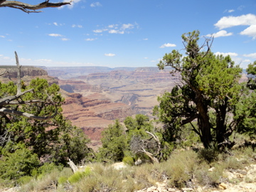
Lovely view. But this is why we chose to take the gondola and not try to find parking.

We spent the next couple of hours doing our tourist thing--visiting the shops. I ended up buying a beautiful t-shirt embroidered with colorful dragonflies and a popsicle maker. (Yeah, I know it's not a souvenir, but I'll be able to easily make all kinds of popsicles from things like juice, yogurt, coffee, and more.)

We settled on Chinese food for lunch--lots of it at a good price.

As we made our way back towards the gondola, we went back through the farmers' market. I picked up yellow beans, zucchini, cabbage, and a couple of chocolate shortbread cookies. I'd thought about some beef or lamb, but Don convinced me we really didn't need any (yet).


These young men played some mellow folk music to entertain the shoppers at the farmers' market.


Don patiently waited for me while I did a little more browsing.


On our return gondola rife, we got off at the top to stretch our legs and see the views. This one is of the mountains near Lizard Head Pass. That's Lizard Head on the far left. The tallest three peaks are all fourteeners: Mt. Wilson, El Diente, and Wilson Peak. The large mountain just to the right of Lizard Head is Sunshine Peak.


This is Lone Cone, the farthest west mountain in the San Juans.


Next to the ski routes map is a placard about the mining history of the area.


Looking east and down to town.


I really wish I could figure out how to look better in these photos!


- Posted using BlogPress from my iPad

Along the Dolores River

Wednesday, July 25

We spent 3 days on the Dolores at our boondocking spot. Since we were close to Rico, I dropped Don off about 2 miles north of our site and he fished his way back to camp while I went to Rico to use their WiFi.


This is where I dropped him off, looking downriver.


He said it was a pretty steep trail, but he made it without falling.


One of the days we drove up to Trout Lake, which is just the other side of Lizard Head Pass (about 10 miles).


I snapped a photo of the lake, and had settled down with a good book when Don discovered he'd left his fly box back at camp. So, he didn't fish there that day.

After 3 days south of Rico, we moved to Cayton Campground north of Rico, where we have electricity. We don't have water or sewer, so we'd planned to dump when we got there and use our hose to fill up the fresh water tank. Unfortunately, the camp host (who locks the dump cap) was not there when we arrived. After waiting for 2 hours, we finally decided to take our site and use our portable tank to make some room in our black water tank. The camp host showed up around 5 pm, and said he'd gone to Ridgway to do laundry. He told us we could dispose of our gray water out in the field, so we figured we'd make it the 5 days we're here.

We tried for a few hours to get our DirecTV to work, but soon came to the realization that the satellite is behind a mountain. So, no TV. No radio. As I write this, the Olympic Opening Ceremony is on, and we've already missed a US Women's soccer game. Oh well. We'll survive.

I did want to mention this place:


We went to Rico to eat dinner a couple of nights ago, and the place we'd planned on eating at was closed. So we went to the Enterprise Bar and Grill. We had the best hamburgers we've had in a long time. The beef is from Colorado cattle, grown near Delta. So, so good.

- Posted using BlogPress from my iPad

Monday, July 23, 2012

Boondocking on the Dolores River

Saturday, July 21

After leaving Navajo National Monument we stopped for 2 nights at the Dolores River RV Park in Dolores, Colorado. We needed to dump, take on fresh water, and do some laundry.

This morning, after a wonderful breakfast of berry waffles and bacon, we hooked everything up and headed up the river. From previous trips, we knew about a couple of places south of Rico where we could park the trailer next to the river and camp for free. Yesterday, Don had come fishing up this way so he could check the spots out, and reported that one area was full and the other was impassable due to giant holes in the dirt road.

So, we were prepared to strike out and continue north to the Cayton Campground this side of Lizard Head Pass. However, when we arrived at the first spot, we saw that one of the sites had been vacated. Hooray!


We backed in to the site easily, and I think it's perfect! We have gravel on our "porch" instead of dirt, we can hear the river since it's only 10 yards away, and there are tall pines on 3 sides to keep us shaded from the sun. I put out my solar lights (the kind that have hummingbirds and dragonflies on them) and noticed a few hummingbirds darting around. Within seconds of hanging up the hummingbird feeder, there were two thirsty little birds drinking from it.


These are our neighbors to the north, but I took this photo just before the closest one left. Now we only have the two units that are the farthest away as neighbors. In this photo, the highway is to the right, and the mountains in the distance are the Rico Mountains. Not a bad place for free!


Right behind the river is a shaded alcove next to the river. I sat here and read for several hours this morning while Don went fishing. This afternoon the clouds rolled in, bringing thunder, lightning, and lots of rain.

Dinner was oven-fried halibut and some red potatoes. Right now we're sitting inside--Don's reading--while the generator recharges the batteries. We can hear more thunder as it continues to rain. It's so nice to not be hot!

- Posted using BlogPress from my iPad

Thursday, July 19, 2012

Navajo National Monument

Wednesday, July 18

After leaving Desert View, we exited the park and continued east, where we passed Cameron and Tuba City. About 30 miles north of Tuba City is the turnoff for Navajo National Monument. For over 20 years we've passed this turnoff, and have said over and over that someday we'd stop here. This time it was the perfect location for a stop (especially since we like shorter days now).  Navajo National Monument is 10 miles up a nice paved road, and sits at 7200 feet on the Shonto Plateau. There are several huge canyons that are part of the Tsegi Canyon system - miles and miles of Navajo Sandstone. I never knew this was here! 

The monument protects and preserves three major Indian Ruins, two of which are semi-accessible to the public. Inscription House is closed to the public - it's in the shallowest alcove, and is therefore the most fragile. Keet Seel is open only to hikers who sign up in advance for the 17-mile round trip hike. Once they get to the ruins, they have to be led through by a ranger. Most hikers stay overnight at a primitive tent campground before they hike back to the main part of the park. I asked where Keet Seel was on the map, and the ranger at the visitor center said they don't show it since it's off-limits except to the ones who sign up.  He also mentioned that they often get people here who think they're going to Monument Valley. 

Betatakin is close to the visitor center. There's a paved hiking trail from the visitor center - 1.3 miles round trip - that goes to a viewpoint across the canyon from the alcove.

Looking west towards the top of the canyon - all the sandstone is Navajo Sandstone.

The path we took. See the canyons ahead?
First glimpse of Betatakin

The alcove in the center is where Betatakin is.

Home for about 75 people back in the late 1200s.

Free binoculars to view the ruins.
We had hoped that the high altitude would mean cooler temps - but it was HOT today. We're in the free campground provided by the park - there are 3 sites large enough for our trailer. Ours is a bit slanted, even after levelling, but it's just for one night so it'll do.

We spent the afternoon sitting in our chairs chasing the shade. The door side of our trailer was getting the sun full-on, so it wasn't cool enough to go inside until about 7 pm. 

Sleep was difficult - we never needed any covers at all since it stayed pretty warm.

Thursday, July 19

Happy Birthday to my big brother Chuck!

We decided to not cook breakfast this morning - and went the 20 miles to Kayenta where we ate at McDonald's.  When we left the restaurant, an old woman sitting in a car yelled (nicely) at us that she had jewelry for sale.  We said "no thanks" and continued towards the truck. Three men were sitting in the shade nearby, and one came over to ask for $ so he could eat. We said no, and he went back to his friends. We saw them taking turns asking people for $.  Then, after we got in the truck, another man knocked on our window and held up a gas can. He said his truck was out of gas and wanted us to give him a gallon. Don thinks he saw our 5-gallon cans in the back of the truck (locked inside the camper shell). Once again, we said no.  I think that if we had said yes to one, or showed interest in the jewelry, we might not have made it out of the parking lot without being approached by many more. It's a very sad situation there in Kayenta. It wasn't like that the many times we've been there before - must be the economy.

Grand Canyon - Desert View

Wednesday, July 18

Knowing we had a short day ahead of us, we enjoyed some coffee and banana muffins for breakfast before hitting the road. We had to go through the eastern part of the park, which took us through the fir/pine forest for miles and miles along the rim. Just before we started out of the fir and pine forest I saw a herd of about 7 javelina!  I've never seen them before in the wild. We stopped at Desert View for a while - the last viewpoint in the park before you hit the East Entrance. There's a tower there, built in 1932 by the Santa Fe Railroad. It has a gift store in the bottom, and you can climb up to the top via several sets of winding stairs (gasp, gasp).


View north up the canyon from the tower

View west from the tower
Looking up at the ceiling of the tower

Murals in the tower are by Hopi painter Fred Kobotie

Looking north from the top of the tower


Looking eastward towards the desert and Cedar Mountain

Grand Canyon - South Rim views


Tuesday, July 17

We got an early start on the day - but not after an enjoyable coffee together in the coolness of the morning. We had a quick breakfast of bauernfrustuck and headed off to see the canyon. We parked at the giant visitor center parking lot and walked out to Mather Point.


We then went to the Visitor Center and saw a 30-minute video about the canyon, and looked at a few exhibits. From there we  hopped on the Yellow Route bus that took us out to Yavapai Point.There's a geology museum there, as well as a few viewpoints for seeing the canyon.


This is the top portion of the Bright Angel Trail

Bright Angel Trail
The yellow bus took us back to the visitor center, where we then hopped on a blue bus. This one took us through the main commercial portions of the park (stores, campgrounds, lodges/hotels, train station, etc.) and then to the transfer station for the red bus that would take us along the rim.

The red bus stops 6 times along the way out to Hermit's Rest, and 3 times on the way back. We decided to go all the way out to Hermit's Rest on the bus, and then hike along the rim as much as we could back to the transfer station.


The Colorado River was running really red today due to rains and floods in the tributaries upstream


At one of the viewpoints, we asked a young man to take our photo.  I don't really like either one of these:

Hats on - can't see our faces

Hats off - definitely senior citizens!

Barely visible down there are the ruins of a cabin and the remains of a mining operation.


We finally made it to Powell Point, where we caught the red bus back to the transfer point, then the blue bus back to the Visitor Center and our truck. I was really glad I'd taken a bottle of water, but it wasn't enough. At Hermit's Rest we'd had two sandwiches and two lemonades for $13 for lunch, so we were happy to find iced tea at the store next to the Visitor Center.

Back at the campground, dinner was crusty French bread and brie, and a green salad. My sister Marilyn had suggested the bread and brie for a lunch idea; it sounded light and tasty after a long hot day. We sat outside until dark - and enjoyed seeing the stars come out.