TALES OF OUR TRAVELS AND OUR LOVE OF ADVENTURE

Friday, September 21, 2012

Up Henson Creek


Today we drove up Henson Creek to Capitol City, in search of fishing, yellow aspens, and historical sites. We checked all three off the list.

Hard Tack Mine - once a working mine, now a summer attraction that offers tours. We took one about 15 years ago and I remember it was pretty interesting.


 This is the site of Capitol City, established by George Lee in 1877. He thought it was in such an ideal location that it was sure to become the capitol of the state.  It had 400 people in its heyday, and now all that's left are a couple of old cabins and two brick kilns.


 This is one of the two brick kilns. The photo was shot from far away; there's a large swamp between the road and the kilns.


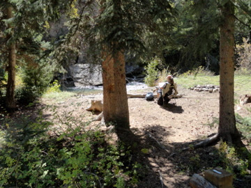
We stopped at a good spot where Don could fish the creek for a while. This is what I do when he fishes.

 Remnants of one of two dams on the creek, built in the late 1870s by the operators of the Ute-Ulay Mine.

 The old settlement of Henson was founded in 1871, along with the Ute Ulay Mine - which still remains an active claim. They're just waiting for the price of silver to go back up!

 Don's reading the placard about the mine strike back in the 1880s.


This is the lower of two dams built on the creek.


Wednesday, September 19, 2012

Back up to Rito Hondo; Quilt Show in Creede

Yesterday we went back up to Rito Hondo; while Don wanted to fish the little lake again, our main purpose was to see what the aspens looked like.  We saw that most of them have turned and there are even patches where all the leaves have fallen off. That happened up on the mountain across from our campground, too - a cold front came through with some big wind gusts, and cleared big patches of aspens.


 This is Mount Baldy Cinco, 13,383 feet.  It's visible from across the upper Cebolla Creek Valley. It's the first mountain south of Spring Creek Pass along the Continental Divide Trail (going north).

On Friday, Don and I went over to Creede to the Silver Thread Guild's annual Quilt Show. You can read all about it here.


Thursday, September 13, 2012

First Snow

 Yesterday's rain brought snow above 12,000' - the first snow of the season. Today Don went fishing in the morning, then this afternoon we hopped in the truck and drove up the Lake Fork.  As the valley opened up we could see the snow on the higher peaks.

 Looking south up Cuba Gulch


 Sunshine Falls


Tuesday, September 11, 2012

More yellows, and a harrowing experience

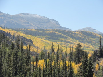
Each day brings more yellow. There are even some reds mixed in.


Today the weather forecast was for a 30% chance of thundershowers, so we risked a trip up Cebolla Creek. First you have to drive the 20 miles downriver from Lake City, go over the divide between the Lake Fork and the Cebolla Creek drainages, and then pick up the unpaved road that goes up Cebolla Creek.  For the first 15 miles or so, you're on mostly private land, as the creek meanders down a very gentle grade.  Then after you hit Forest Service land, the road starts going uphill through the Cebolla Creek canyon. We stopped around 11 am at Cebolla Picnic Area, where Don fished for about  an hour and a half.  A few small showers passed through, but around 12:30, it started to rain pretty hard. He came back to the truck, threw his gear in the back and didn't even take time to get out of his waders. "Let's get out of here!"

We headed up the canyon - we should have gone back down - and after we passed Spruce Dispersed Area the road began to get steeper.  Don was trying to make good time, but when we turned a corner we hit some ruts and the truck fishtailed. It's not a 4-wheel drive, and with the back rear end, we fishtailed right into a ditch on the right side of the road. I saw that the ditch was full of rocks, so knowing we had the rocks for traction, I told Don to start backing down. I knew it would get shallower until he could get out of it.  After about 30 yards, the truck made it out of the ditch, but we were almost sideways on the road, with the rear wheel on the left side nearly on the edge (with a 200-foot dropoff). Don gently shifted to low gear and we inched our way through the mud until we were straight, and had enough traction to start going uphill again.

For the next 4 miles we drove through sloppy, muddy, slippery conditions, and only began to breathe easier when we hit gravel. I remember saying several times, "Don't stop!" because I was afraid of getting bogged down.

After about 7 miles we made it to the top of the road - a good 4,000' higher than where we'd started. Pavement.

We headed down Slumgullion Pass back into Lake City, where it's been raining off and on all evening.

Tomorrow Don will go back to fishing where he gets to stay on paved roads!

Friday, September 7, 2012

A Day over 10,000'

We packed up a lunch and left after breakfast today for a trip to Rito Hondo - a small reservoir near Spring Creek Pass.  The aspens are getting yellower and yellower - look for them in the pictures!


 Our first stop was the Windy Point viewpoint, where you can get great shots in three directions. The one above looks slightly northwest towards one of the highest peaks in the area - Uncompahgre Peak (14,309'). Two peaks to the left of it is another fourteener, Wetterhorn Peak (14,013'). The peak on the right overlooks the town of Lake City - Crystal Peak (12,933').

 This is the view looking slightly southwest towards Red Mountain, and just to its left is another fourteener, Handies Peak (14,058').  The picture is a bit blurry, but you can see the swath of yellow on the upper slopes.

This is the view northeast towards the top of the Cannibal Plateau, where, 850 years ago, a huge chunk of the Plateau broke off and slid down the mountain. It formed an enormous slide about 5 miles long, which dammed up the Lake Fork of the Gunnison, forming Colorado's second-largest natural lake, Lake San Cristobal. (The largest is Grand Lake, up near Rocky Mountain National Park.)


Our next stop was Rito Hondo Reservoir, which sits at 10,050'  just below the Continental Divide. Don geared up and took his float tube out for a day of fishing
.


 Success!


There are many cattle grazing up here in the national forest - part of the "multiple use" policy.

On our way back to Lake City, we decided to go down to the Deer Lakes to see if we could find a moose or two. We've been told there's a huge bull and a cow with calf, and since it was late afternoon we hoped we'd see one of them. We didn't. But I did see a couple of pretty ponds:

 This is Lower Mill Creek Pond. 


 Deer Lake #2. Lovely colors!

We made it back down to Lake City in time to have dessert before dinner - ice cream at the Soda Shoppe. 

Sunday, September 2, 2012

My morning hike

We've been here at the Highlander in Lake City for a little over a week now - and I've either sat around watching TV, working on the computer, reading, or sewing.  It was time to get off my butt and start walking.

Up behind the campground is a mountain, and there is a "road" that switchbacks up the mountain from the campsite.  There are 17 switchbacks. The first 3 are pretty long, and end up at a bench that was put there by Don and Dianne.  I decided I will go up to that bench every day for a couple of days, and then go further up. I've been up 12 switchbacks - to where Don has a little water treatment facility for the campground. I'll make it up there by the end of the week.

 Right behind the campground, at the base of the road up the mountain, is Don's waterfall. It's water from a spring high up on the mountain. He diverts some of it for the campground.


 Right next to the waterfall is a sign that notes that this was the site of an old mine.


 A little further up the trail/road is another old mine, the Argus.


 This is the view of the campground from the end of the first switchback. Our trailer is in the center of the photo.

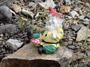
 Diane has placed a dozen or so of these gnomes at various places along the trail/road.

 I've made it to the Highlander bench!


Looking eastward - the Lake Fork of the Gunnison is in the lower part of the photo, and then above it is the Slumgullion Earthflow and Slumgullion Pass.


Looking southeast over the campground towards Lake San Cristobal. We're only about 300 yards from the lake. Don used to walk up there to fish before he started flyfishing rivers.

As I go higher and higher, I'll take more pics.