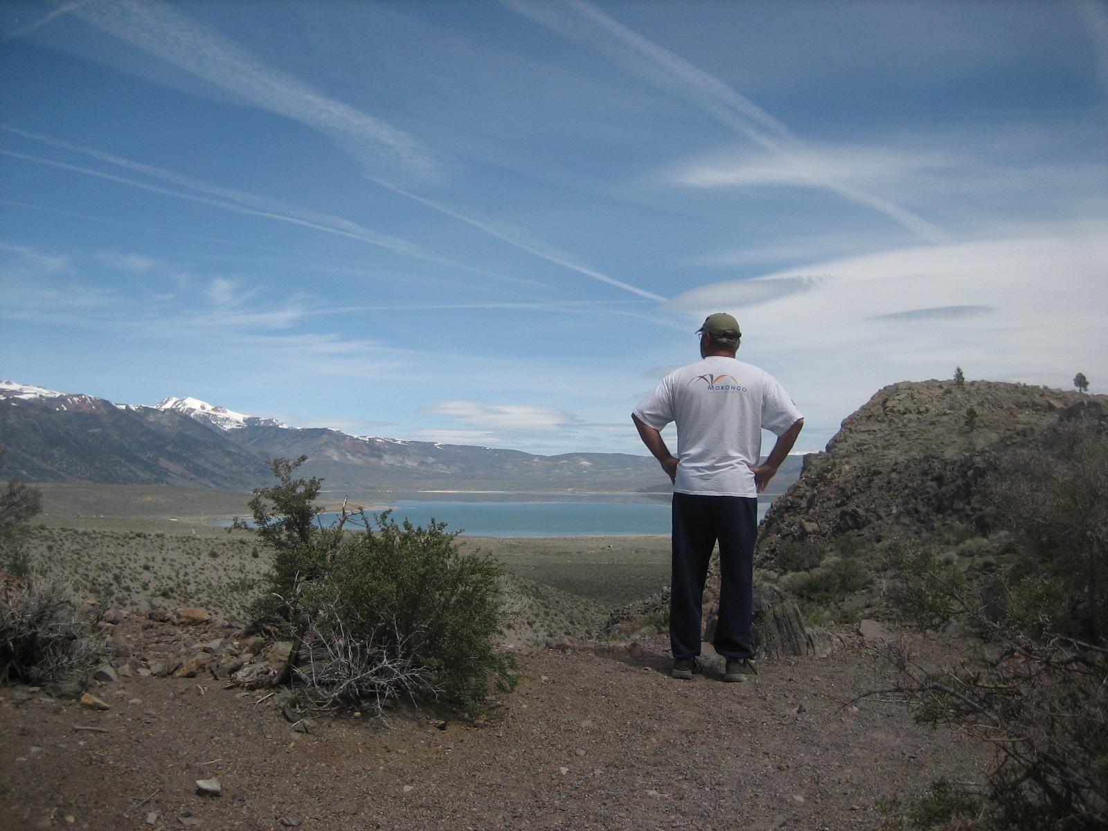
We're back from a fabulous 3-day weekend on the north shore of the Salton Sea. The Salton Sea sits at 224 feet below sea level - meaning it's blisteringly hot during the summer, but during the winter it's one of my favorite places. We left Friday afternoon, and took the drive east on I-10 to the 86S, and where it crosses over the 111, we got off and went south on the 111 about 9 miles to the Headquarters Campground. This is a state recreation area - but the full hookup sites here are only $30 - and since Don's now a real senior citizen, we paid $28 for each night. The 15 sites sit in a row at the upper end of a huge parking lot - which never has more than 2-3 cars parked in it, usually none - with a breathtaking view of the Salton Sea and the Santa Rosa Mountains to the west. There's a well-used train track that runs along the highway behind us, and the trains pass dozens of times each day, both north- and south-bound. Don and I have differing opinions about it. I like it - the rumbling, rumbling, rumbling as it approaches, the horn that sounds as it approaches a nearby crossing - but Don says it bothers him. He's said that he'll put up with it for my sake.
There are several other state campgrounds along the north and east shore of the Salton Sea, but they don't have hookups. Mecca Beach Campground has a dump station, though. Corvina Beach and Salt Creek Campgrounds are laid out in a long line along the beach, and you pull in to your site parallel to the road. Mecca Beach is a loop. If I were camping without hookups I'd pick the two along the beach.
Don went fishing after we got set up - the Salton Sea is crammed full of tilapia, corvina, sargo, and croaker - but none of them were biting. Dinner Friday night was simple - grilled cheese and soup - and we then went outside to enjoy the sunset.
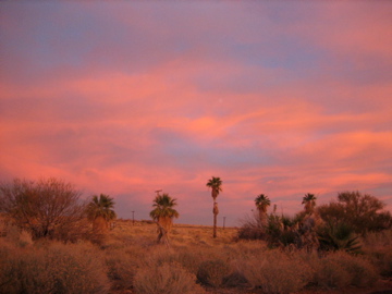
Friday night's sunset. The structures along the water's edge are picnic cabanas.
Saturday morning's sunrise.
Saturday morning we were up before the sun, since we wanted to see the sunrise. Not only did we see that, but we were treated to the sounds of thousands of birds - seagulls, doves, egrets, and many many more that I can't name. (Sometimes I regret not getting into birding, but I've had many other passions in my life and just can't add another one at this stage!) We sat for an hour, enjoying our coffee and the view of the sea.
After a breakfast of waffles and sausage, we decided to take a hike. The camp host had given us a little sheet of things to do in the area, and one of them was a hike into Painted Canyon in the Mecca Hills Wilderness. I had no idea either existed. We drove back up the 111 to Mecca, then took Box Canyon Road east out of Mecca to the turnoff for Painted Canyon Road. That road was only graded this past week - many parts of it had washed out after the winter storms. This area has some twisted and turned rocks and hills due to its location along the southern end of the San Andreas Fault.
The Mecca Hills
Our road was going to end up in the far left of the picture, between the very low light hills and the higher dark hills.
When we got into the canyon, we hit a very sandy patch in the road - the truck bogged down, and Don was worried we were going to get stuck. Our truck is light in the rear and is not 4WD, so getting stuck in the sand was a strong possibility. He backed up onto a solid piece of ground to the side of the road, and we decided to hike from there. We noticed several places set aside for 14-day camping, but saw only some young men with their tents. This would make a great boondocking spot if you could get past the sandy portion of the road.
Some of the rock layers that are standing on end in this part of the canyon.
The view back west, down the canyon. The tallest peak to the right is Santa Rosa Peak. It's at the center of its own wilderness.
Looking east up Painted Canyon as we began our hike.
The canyon begins to narrow.
As we hiked up the canyon, we were passed by about 4 Jeeps, trucks, and cars. About 2 miles in, we arrived at the parking area for Painted Canyon. There were already 5-6 vehicles there. From this point, according to a sign at the entrance to this part of the canyon, you're in the Mecca Hills Wilderness.
A pair of hikers heads into the narrows.
Don
Yours truly!
As we continued towards the narrower part of the canyon, I developed a pretty painful tug in my right groin, and we were forced to turn around since we knew we had a pretty good hike back to the truck. (That groin pull is still pretty tender - I have to lift my thigh with my hand if I want to raise my leg. That's what I get for being out of shape!)
On the way back, I was drawn to this area of greenery - and discovered a seep (small spring) at the base of the canyon wall.
We made it back to the campground in time for the two football games - and since I really wasn't interested in the first one, I decided to go in search of the closest geocache I could find. This one was called Bob Uker Seats. It was located at the Mecca Beach Campground, in the rear of the outdoor amphitheater. It was hidden under a bush.
The general area of the cache.
The cache is back in those bushes!
After locating the cache and submitting my "find" report, I came back to the trailer and watched the football games with Don. Dinner was a treat - steak, dilled new potatoes, and peas.
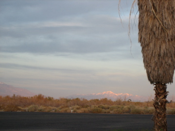
Sunday morning again found us enjoying the sunrise with our coffee, and Don pointed out how the sun was hitting "our" mountains. We live up in the ones in the picture below - and believe me, we were glad to be leaving that snow behind for the weekend!
Sunday morning's sun hits the San Bernardino Mountains
Breakfast was biscuits and gravy - I had to use up the other half of the package of Jimmy Dean. Since the football game was coming on earlier than the day before, I told Don he didn't have to go with me on the morning's exploration. I had heard about the mud pots and mud volcanoes, and had go find them.
First, I went south on the 111 about 26 miles to the Wister Waterfowl Managment Area - turned right and headed towards the Salton Sea. I saw the small "Mud Pots" sign, and followed the road to where it ended.
"Boiling mud? Actually, it's carbon dioxide gas rising from below the water table. Mud pots are vent points and they tend to occur along the earthquake faults which run through this valley. Look for them along this field between here and the Salton Sea."
View from the parking area. Two large and one small hole.
This one, which was quiet while I was there, showed signs of recent activity.
This one appeared to have been dormant for a while.
So, I was a bit disappointed that the mud pots weren't bubbling. I'd seen a couple videos of them on YouTube, and was hoping to see them in action. Oh well.
From there I headed south in search of the Mud Volcanoes. I found them - but you can't get close to them since they're surrounded by a deep canal and then a field of mud.
Here's a very well-done video of the Mud Volcanoes:
The Mud Volcanoes
I made it back in time to watch most of the football games with Don - way to go, Jets! - and then we enjoyed some barbecued chicken and yet another gorgeous sunset.
The colors darken in the eastern sky
I was able to capture the moon in this one
I can't get enough!
Love the red glows in the western sky
Last one.
This morning we enjoyed our last sunrise, then a breakfast of corned beef hash and eggs. We were packed up and on the road by 9, and made it home in time for lunch. There's still snow on the ground here, but it was 55˚, so it continues to melt. Inside the house it was 48˚ - the heater ran for a long time to warm it up, and now Don has a nice fire going. Back to work tomorrow!
Today was a little bit frustrating and a little bit exciting. We found one cache and didn't find two - for two different reasons.
We started the morning with cereal, since we both gorged ourselves at last night's barbecue and potluck. After watching a little of the World Cup soccer, we decided to go find a couple of caches in Lake City. I thought we'd start with the easiest one first. It was NOT easy. The terrain was easy, but we never did find the cache, even though my GPS showed we were right on top of it. It was a micro, and was definitely hidden very well. We searched for 30 minutes with no luck, and around noon, we both decided to give up and get some lunch. That cereal just didn't last.
Lunch was great - we visited the Tic Toc Diner, which wasn't even 100 yards away from where the cache was. Don had a hoagie/sub called the Ham Load - and it had ham, cheese, and grilled bell peppers - an unusual combination, but something he really enjoyed. I had the cheeseburger - which came with grilled onions on it. Yum.
Our next attempt at finding a cache was successful. This one was about half a mile up Henson Creek along a pedestrian/hiking trail, and right next to the creek.
It was micro, so all we could do was sign the log - and we learned that we were the first to find it. Yay! Our first "first!" We got back to the truck and I realized I'd forgotten to put the date on the log - and while I went back to do so, I lost Don. Wouldn't you know, he'd gotten his fly rod and was trying out the creek!
The next cache was supposed to involve a little bit of a hike. We found the parking area, and then the trail - which headed nearly straight up the mountain. The description stated that it would "start out steep, then level out." One of the logs (from a previous finder) stated that the steep part was only 20 yards. WRONG. The angle was extremely steep - dangerously so, for coming back down - and was at least 100 yards as far as we could tell. However, after about 30 yards, we decided to give up. (Add to that, the mosquitoes were eating me alive!) Don almost fell coming back down (which only bolstered our decision to quit.)
We came back to the trailer about 2 - and of course, Don decided to go fishing. I crashed. I felt like I'd climbed a mountain. Must have been the overeating the night before (and the hamburger for lunch) that made me feel so sluggish. I slept for an hour, and have been relaxing and browsing the internet.
Don just came back - said he had some great catches today. One was a 2 1/2-3 pound rainbow, another about 2, and the third about a pound and a half. He never expected to catch any fish at all in the heat of the day, so he feels pretty good about his success.
We're kicking back now watching tv and enjoying the cool evening. I'm sure we'll both sleep well. I'm heading to Gunnison in the morning - I need to get my nails done and do some grocery shopping.
Thursday, June 17: Don wanted to do a little fishing at Rito Hondo Reservoir, which is up past Slumgullion and Spring Creek passes near the Continental Divide. When I looked up caches in the area, I saw that there was one at Slumgullion Campground, which was on the way, as well as a couple others.
When you're using an iphone for geocaching, you can't find any or use the application if you don't have cell phone reception. What you need to do is write down the coordinates beforehand, and use either a GPS or the GPS application on the iphone to locate the cache. This was the first time I'd use the GPS app, so it took a lot of tramping around in the woods to find the cache.
This is the old road from the campground that we followed for about 2/10ths of a mile too far:
Once I figured out where we were supposed to be going, we headed off into the forest. I had my iphone and notepad in one hand, and my camera in the other - so when I tripped over a log, I had no choice but to do a faceplant into the brush. My right leg caught on several broken off limbs - and I scraped it badly in 3 different places. Upon standing up and brushing myself off, I was relieved to learn I hadn't broken any bones or tweaked any joints - but my leg sure was a mess on the outside!
It didn't take me more than 2 minutes after that to spot the cache - that horizontal log just looked a bit out of place:
This cache was a 2-quart jar covered in cammo tape, and it had all kinds of swag inside. I signed the log, left a domino, and took an Air Force lanyard to drop off at our next find.
Our next stop was North Clear Creek Falls. The stream meanders through an 11,000' valley for about 6 miles, then drops off a basalt cliff:
There is a cache nearby, but for some reason, my GPS was telling me that it was 8 miles away. I checked on the correct coordinates when we got back to the trailer, and I'd written them down correctly; I don't know what I did wrong for this one. We're going to try it again in a few days since we want to go to Creede and it's on the way.
After the falls we went over to find a cache that was supposed to be near a waterfall going into Brown Lakes. This was a fun one, and I did a better job using the GPS. At first we were on the wrong side of the falls. We moved over to the other side, and it took about 10 minutes of climbing up the left side of the falls to find the cache. It was a 3" thick PVC pipe, about a foot long - also with a log and swag. I dropped off the Air Force lanyard and a domino, and took a wooden geocaching token from a Kansas University geocaching club.
Here are the Brown Lakes. The large mountain in the center is the Rio Grande Pyramid.
When I did a search for geocaches in or around Lake City, we found two that were pretty close. (The rest are up in the mountains or up Henson Creek canyon.) The first one was underneath a pedestrian-only bridge across the Lake Fork.
Using the clues, we searched for about 15 minutes on the wrong side of the bridge. When we decided to go to the other side, we found it easily.
The second cache of the day was a virtual cache - and we had already visited that site during previous trips to Lake City. We went back, found the answer to the question, and claimed the "find." This one has a lot of history - it's the memorial site where Alferd Packer killed and then cannibalized his companions during a disastrous winter expedition.
Here's the story:
If Hannibal Lector had a Grandfather, his name would be Alferd Packer, a man convicted of eating his partners. The Packer case was the first, and possibly the only incident of cannibalism tried in the U.S. court system.He was born in Allegheny County, Pennsylvania in 1842 and migrated west in 1862. There is some confusion about the spelling of his first name. His tombstone reads "Alferd" and some say he spelled it this way. In the winter of 1873 he was hired as a guide in Salt Lake City by 20 men for a prospecting trip into the San Juan mountains of Colorado. He claimed to have driven an ore wagon in some of the mining camps of Colorado and that he could lead them to the valuable ore they were looking for. In truth, he knew very little about this region. In January 1874 the group stopped over at the village of Chief Ouray and were warned not to try crossing the mountains until spring. Packer and five of the group decided to continue on into the mountains. During early spring the rest of the group traveled across the mountains and inquired about the Packer party. A search team was then sent out to look for the missing men. Two months earlier, Packer had appeared at the Los Pinos Indian Agency looking fit and well fed. His primary interest was in obtaining some whiskey, not food, and he had a large roll of money to pay for it. He first said that he had been left behind by the others due to a leg injury. His story was to change several times...later being that one of the men went berserk and killed the others and that he had shot the man in self-defense. An Indian guide found strips of human flesh on the trail and Packer was questioned. In August of 1894 the camp of the five missing men was found near Slumgullion Pass, 2 miles from Lake City. Packer was jailed in Saguache and later escaped to Wyoming, and for 9 years lived under an assumed name until his capture. Packer was returned to Lake City in 1883 to stand trial. The verdict was guilty, with death by hanging. The legend was that Judge Melville B. Gerry, on pronouncing sentencing said..."...There was siven Dimmycrats in Hinsdale County! But you, yah voracious, main-eatin son of a bitch, yah et five of them, therefor I sentence ye T' be hanged by the neck until y're dead, dead, dead!". This was probably not the exact statement made by the judge as he was a well educated man, but makes for good story-telling. Later the sentence was reduced to manslaughter and he was given 40 years to be served at the prison in Canon City. See http://www.archives.state.co.us/packer.html for additional information on Mr. Packer.
While Don was fishing between thunderstorms yesterday, I decided to got try to find a couple geocaches that were in the area.
The first one was supposed to be an easy find - but, once again, I made the mistake of not wearing my hiking boots. In addition, as soon as I got to where the cache was supposed to be, I lost cell phone reception and couldn't get more information (such as hints and logs of other people). It appeared that the place I needed to go look was across a small ditch and in some thick brush. Oh well.
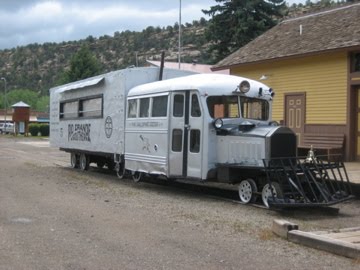
The second one was a "virtual" cache - you go to the coordinates, and then answer a question posted by the person who "placed" the cache. In this case, the coordinates were in downtown Dolrores, next to the railroad museum. The question had to do with the Galloping Goose parked out front. I answered the question via email, and was rewarded with a response that had links to several videos about the Galloping Goose. These were "busses" equipped for rail use to carry people, equipment and light freight between Dolores and Ridgway during the 1930s and 1040s.
The next cache was also railroad-related. It was along an old railroad bed in Lost Canyon, to the east of Dolores. I spent about 15 minutes walking along the wrong side of the creek, but once I figured that out it was an easy find.
After visiting the South Tufa towers, we thought we'd stop by Panum Crater for a look. I saw on my Geocaching app that there was a cache at the top - so we decided to go find it.
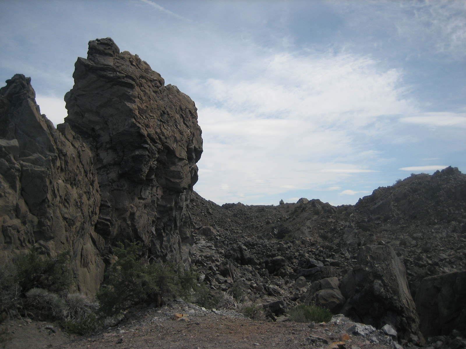
Panum Crater is a rhyolite dome crater - meaning the typical round crater with an indention formed first, then a hard lava plug formed in the middle. In Panum, the plug is made of obsidian and rhyolite, and is higher than the rim of the crater itself. Below is a tower of obsidian about halfway up the climb.
Here, Don stops about 2/3 of the way up. He's looking north towards Mono Lake and Lee Vining. In the center right of the photo you can see a ridgeline with two pine trees - we were headed for the pine tree on the right.
This is a shot looking northwest from the cache.
This is looking south from the cache.
Here's another shot of the ridge line we'd climbed - it was a bit steeper than it looks, but we had no problems. The hike back down was nice, except I hadn't planned on hiking, and was wearing Keen thong sandals. I kept getting rocks under my feet all the way down. I sure was glad when the trail leveled out. I've learned my lesson - always keep the hiking boots in the truck!
After we found the water truck cache, we spent a couple more hours tracking down some more caches. All off these were quite easy - since the one that was difficult was the one we didn't find!
This one was our first micro/small cache. It was a "log only" cache, and it was in this railing - attached with a magnet.
Next up was one associated with a view of Gull Lake. We found it after scrambling around some pretty large boulders on the side of a steep hill - but it was a blast trying to get the GPS to hone in on it.
This is the view associated with this cache: Gull Lake with June Mountain behind it.
Don found the next one - after I spent a long time looking around on the ground. I won't tell you where it is, but he spotted it after standing back and looking for something out of place with nature. In the photo below, he's standing at the mouth of June Lake Mine - something we never knew existed in our 20 years of coming to June Lake.
The mine is situated in the center of the picture below:
The next cache we found was another micro, and it was located here:
The last one for the day was at Gull Lake. When we parked, my GPS was pointing right AT it, and I briefly thought it would be there - but I misread the description. We spent 10 minutes looking for a LOG, when we should have been looking for a ROCK. Once I re-read the directions, I went right back to the original spot and pulled out the little camo box. It had some of those little monkeys from the game "Barrel of Monkeys," so I took one of those and left one of my dominoes.
The one we didn't find? Well, it should have been on the side of a hill, under a bush, next to a pile of rocks - and we looked for 30 minutes and never found it. Pretty frustrating; but I guess that happens!