TALES OF OUR TRAVELS AND OUR LOVE OF ADVENTURE
Showing posts with label Eastern Sierras. Show all posts

Friday, May 10, 2013

It is so pretty here!

This morning the sun was finally out with no clouds in the sky at all. 


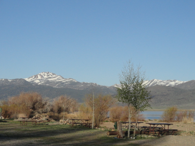
This was the gorgeous view from our campsite this morning.


I walked over to the edge of the campground to get a nice shot looking west up into the Emigrant Wilderness.
Peaks of the Emigrant Wilderness


Since the wind wasn't blowing, Don decided to try his luck in the float tube on the reservoir.  He walked out to the edge from our campsite, and came back 5 minutes later. He said he'd gotten about 15 feet away from the shoreline, and started to sink in the mud. The water was still not deep enough to sit down in his tube. So, he took the truck down to the dam, where he could put the tube in easier. He returned around noon, since the winds started to pick up, and said he hadn't gotten a single bite.  (This was after having 5 straight days on the river with lots of fish biting.)  I suggested he go back on the river, but he said someone told him the fish were biting on Lower Twin Lake, and was going to go up there.  He also thought it wouldn't be as windy up there.


He just came back a few minutes ago (dinnertime), and said he didn't get a single bite up there, either. And to top it off, he'd forgotten to put any beer in the fridge to get cold, so the day was just a total loss. ;)

I sewed all day - I brought a tub of "kits," which are made up of fabric I pre-cut into all the necessary parts for quilt tops.  I'm halfway through my second top of the trip.

Thursday, May 9, 2013

Bodie State Historic Park

So far, the weather here in Bridgeport has been what the meteorologists call "unsettled."  We've had wind, rain, hail, and sun, and it's all been cycling through constantly since we got here. Don has still managed to get down to the river each day, and he doesn't mind getting wet when it rains anyway. I've stayed here in the trailer and sewed or read.

Today we had the promise of better weather, so we decided to go to Bodie.  Gold was discovered in Bodie in 1859, and by 1879 10,000 people were living there. Now only about 5% of the original buildings remain, but there are plenty for visitors to see. Don and I went there back in the early 90s with the kids - we drove the washboarded dirt road from Mono Lake.  Neither of us remembers much from that visit, other than the fact that it was fast and we didn't see much.  This time we decided to take our time.

To get to Bodie, you drive south on the 395 to the turnoff at Virginia Creek Settlement, then take a paved road up into the Bodie Hills 9 miles to the dirt road.  There it's only 3 miles more to Bodie. There's a parking lot with restrooms, and from there you go into the town on foot.  Don and I saw as much as we could - we followed the guide we'd purchased for $2.

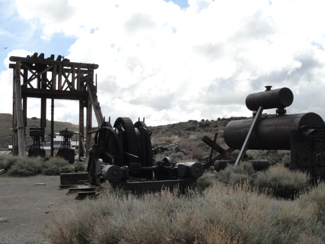
Head frame and machinery next to the parking lot

Commemorative markers

View of Bodie from the parking lot


Methodist Church, erected in 1882
Interior of the Methodist Church
Don looking in the window of the McDonald House

Metzger House

Looking east toward site of Chinatown - several hundred people lived here in a "town within a town." They had their own stores, saloons, boarding houses, laundries, and other services.

Standard Stamp Mill and accompanying buildings

Kirkwood House
Town Jail

All that's left of the Bodie Bank - the vault

The Firehouse

The School House, originally the Bon Ton Lodging House

Looking north up Green Street, with a 4WD road to Bridgeport in the distance
L-R: barn, Post Office/Hotel, IOOF Hall, Miners' Union Hall (now the Visitor Center), Morgue

Swazey Hotel

Stagecoach (in the Visitor Center)

Horse-drawn hearse (in the Visitor Center)
After we walked all over town, we drove to the picnic area for lunch. By then the sun was shining more, and we were okay even though it was windy.

We were going to drive up to the Virginia Lakes to see if they were open, but Don decided that even if they were, it was going to be really cold to fish them. So he decided to come back to the trailer, and now he's out on the river again. I was going to watch the aggravation phase of the Jodi Arias trial, but court has been cancelled until the 15th. So I think I'll read.

Monday, May 6, 2013

Bridgeport

We're now camped in site #19 at Paradise Shores RV Park & Marina on Bridgeport Reservoir. We have a view of the mountains in 3 directions, with the reservoir just in front of us. 

Looking north across the reservoir right after a small hail shower moved through.
We left home around 6:00 yesterday morning, and had a pretty uneventful drive to Bishop. We'd considered stopping in Lone Pine, about 50 miles south of Bishop, but Boulder Creek RV Park sits right on the northern edge of Owens Lake, and the wind was whipping pretty hard through the park. So we kept on going, knowing that we'd be a little more sheltered in Bishop.

In Bishop, we stayed last night at Highlands RV Park, and while it was windy, it definitely was as sheltered as we'd hoped. We finished hooking up around 1:30, and by 2:00 Don was fishing his beloved Owens River. I spent the afternoon watching TV and reading; and Don came back around 5:00. Dinner was our traditional chili dogs - something I started about 8 years ago. (Don't ask me why - but it's now a tradition.) We watched some TV and were in bed by 9:00.

This morning both of us were up pretty early again, so we enjoyed taking our time to have our morning coffee together. After breakfast, we hitched up and were on the road north by 9:00. Don was worried about how the truck would perform going up the Sherwin Grade, as well as Deadman's Summit near June Lake and Conway Summit coming out of the Mono Lake valley. He knew the Dodge would have labored, and since the trailer was loaded for the summer, he didn't know how the Titan would do. It did fine!  I thought the Conway Summit would be the hardest, but we just zipped up it with no problems.

11:00 found us settling in to our site in Bridgeport, home for the next week. Don's getting ready to go down the East Walker River, and is planning some float tube fishing on the lake tomorrow if it's not too windy.  Right now it's calm.  I'm trying to decide whether to sew or read.  Tough choices, huh?!

Sunday, September 18, 2011

Back Home

We had a wonderful trip to Rock Creek and Silver Lake. The first 4 days were up at the East Fork Campground on Rock Creek, about 30 miles west of Bishop. I had been so hot at home that it was nice to be a little cold. I was in long pants, vest, and flannel shirt most of the time at Rock Creek. I didn't take any pictures - I really didn't go anywhere. Don fished up at the lake, or on the creek, and I stayed at the trailer just enjoying the peace and quiet. I spent most of my days in my Strongback Chair, cross stitching or reading. Now that I have that chair, I can spend hours and hours outside and not complain about my back.

Our second destination was the Forest Service campground at Silver Lake, on the June Lake Loop.  We've been going to June Lake for over 20 years, but have always stayed at Oh Ridge Campground overlooking June Lake. We decided to try some place different this time.
Our site, #36, had this view to the south of Carson Peak

This is looking west towards the Alger Creek Waterfall

Alger Creek waterfall
One of our day trips was up Tioga Pass to Saddleback Lake, near the east entrance to Yosemite. We got up there and learned they had drained the lake to about half capacity in order to work on the dam. That didn't deter the fishermen from coming, as the place was quite busy with shore fishers. Don and another guy were the only ones to go out in float tubes.
Saddlebag Lake, looking north

Saddlebag Lake - the view east from my stitching site
Around lunch time the clouds rolled in, and it became a little drizzly and chilly. We drove back down the road and stopped for a couple of hours along Saddlebag Creek. I stayed warm and dry in the truck while Don walked the creek for a while.
Saddleback Creek, looking south

Don, stalking the trout in Saddlebag Creek

Don on Saddlebag Creek
Another day trip was up to the Virginia Lakes. To get there, you take the 395 to Lee Vining, continue north up to the top of Conway Summit, and go left 6 miles to the Virginia Lakes. There are 4 lakes all within walking distance, and we chose to go to Trumble since there were so many people at the others.


The water in Trumble was a murky green, but it didn't hamper the fishing at all.  From my chair next to the lake I watched Don catch fish after fish - over 30 in all.  Of course he put them back.

This trip was a little different from others in that we had no hookups the whole time - and didn't bring the DirecTV receiver for when we were using the generator. We were able to pick up one radio station at Rock Creek and none at Silver Lake, so for 10 days we heard very little news from the outside world. It was rather pleasant. We each had books to read, and while Don fished I either read or worked on my cross stitch.  We realized our trailer batteries need to be replaced - he would run the generator for a couple hours, and then 2-3 hours later the indicator light showed "empty' again. One of the batteries is 3 years old; the other is 4 - so it's definitely time to get them replaced.

We don't have any trips planned for a while. The next one will be towards the end of October when we go with some friends out to Anza-Borrego Desert State Park.
Tuesday, September 6, 2011

Heading up to the Sierras

We're leaving in the morning for a fishing and relaxation trip to the Eastern Sierras.  We've never been able to go in September before, so it'll be interesting to see how many other people there will be. When I got online to make the site reservations, we had no difficulty picking our favorite sites.


Little Lakes Basin in the John Muir Wilderness
Our first stop will be along Rock Creek, at the East Fork Campground.  It's only a couple of miles from where I shot the above photo the last time we were there.  Don intends to a)fish Rock Creek, b) fish Rock Creek Lake, and c) hike into the John Muir Wilderness again to Little Lakes Basin to fish as many of the little lakes he can.  I'll be going with him on that hike - it's a really easy hike from the Mosquito Flats trailhead into the wilderness.  I intend to a) read, b)cross stitch, and c)do nothing.


Carson Peak, seen from Oh Ridge Campground at June Lake
Our second stop will be at Silver Lake Campground on the June Lake Loop.  In the past, we've always stayed at Oh Ridge Campground overlooking June Lake, but this time we'll stay at Silver Lake Campground.  In the above photo, it would be at the base of and to the right of the large mountain.  Don intends to a) fish Silver Lake, b) fish Rush Creek, c)fish Grant Lake, d)fish Gull Lake,  e)fish June Lake, and f) go up the Tioga Pass road towards the Yosemite National Park west entrance and fish Saddlebag Lake.  I'll go with him on that trip. In addition, I intend to a)read, b)cross stitch, and c)do nothing.

Sounds like a great trip, doesn't it?!  We won't have hookups, and I won't have internet access, so I'll post pics in about a week and a half. 

Wednesday, June 2, 2010

Panum Crater - and a geocache on top

After visiting the South Tufa towers, we thought we'd stop by Panum Crater for a look.  I saw on my Geocaching app that there was a cache at the top - so we decided to go find it.

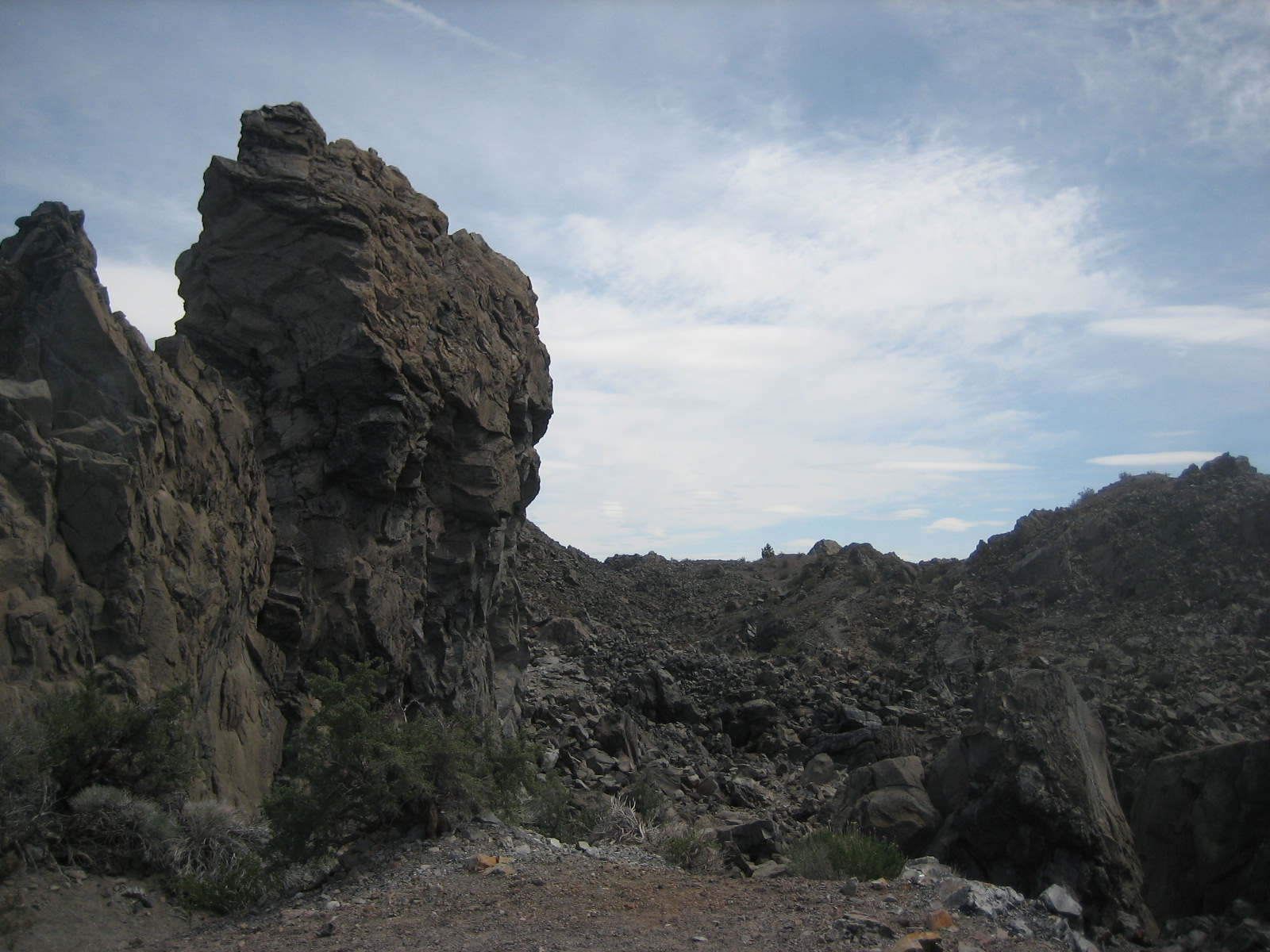
Panum Crater is a rhyolite dome crater - meaning the typical round crater with an indention formed first, then a hard lava plug formed in the middle.  In Panum, the plug is made of obsidian and rhyolite, and is higher than the rim of the crater itself. Below is a tower of obsidian about halfway up the climb.


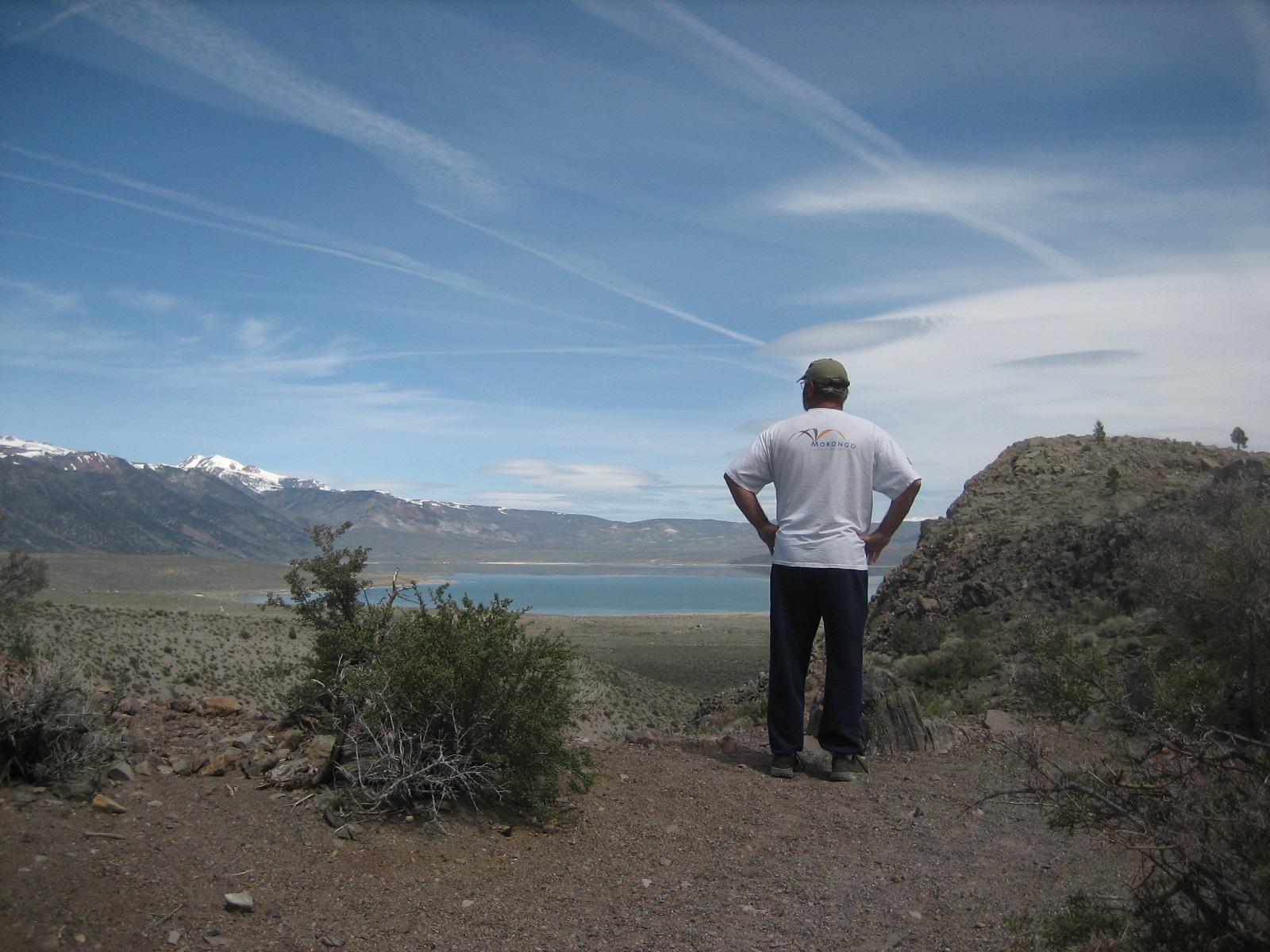
Here, Don stops about 2/3 of the way up. He's looking north towards Mono Lake and Lee Vining.  In the center right of the photo you can see a ridgeline with two pine trees - we were headed for the pine tree on the right.


This is a shot looking northwest from the cache.


This is looking south from the cache.


Here's another shot of the ridge line we'd climbed - it was a bit steeper than it looks, but we had no problems. The hike back down was nice, except I hadn't planned on hiking, and was wearing Keen thong sandals.  I kept getting rocks under my feet all the way down. I sure was glad when the trail leveled out. I've learned my lesson - always keep the hiking boots in the truck!

Mono Lake - South Tufa Towers

Last summer we stopped at the Mono Lake Visitor Center, but didn't take the time to go see the tufa towers. This time I told Don we were going to go see them. There's a nice trail through them, with interpretive signs.  We were able to see some of the brine shrimp, as well as lots of gulls, ospreys, and other birds.


As were were leaving, this couple came down to the water's edge.  The woman had on a wetsuit under her robe, and was carrying a metal box (camera? makeup?).  She and the guy were looking for the right place for a photo shoot - for the wetsuit.

More Geocaching

After we found the water truck cache, we spent a couple more hours tracking down some more caches.  All off these were quite easy - since the one that was difficult was the one we didn't find!

This one was our first micro/small cache.  It was a "log only" cache, and it was in this railing - attached with a magnet.


Next up was one associated with a view of Gull Lake.  We found it after scrambling around some pretty large boulders on the side of a steep hill - but it was a blast trying to get the GPS to hone in on it.


This is the view associated with this cache:  Gull Lake with June Mountain behind it. 


Don found the next one - after I spent a long time looking around on the ground. I won't tell you where it is, but he spotted it after standing back and looking for something out of place with nature. In the photo below, he's standing at the mouth of June Lake Mine - something we never knew existed in our 20 years of coming to June Lake.  


The mine is situated in the center of the picture below:


The next cache we found was another micro, and it was located here:


The last one for the day was at Gull Lake.  When we parked, my GPS was pointing right AT it, and I briefly thought it would be there - but I misread the description.  We spent 10 minutes looking for a LOG, when we should have been looking for a ROCK.  Once I re-read the directions, I went right back to the original spot and pulled out the little camo box. It had some of those little monkeys from the game "Barrel of Monkeys," so I took one of those and left one of my dominoes.

The one we didn't find?  Well, it should have been on the side of a hill, under a bush, next to a pile of rocks - and we looked for 30 minutes and never found it.  Pretty frustrating; but I guess that happens!